
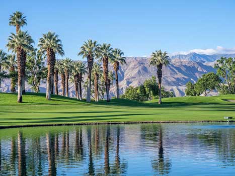
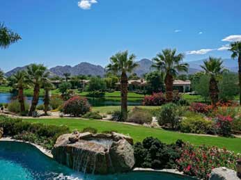
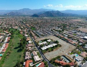
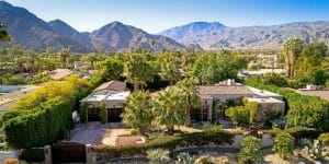
Bermuda Dunes
Bermuda Dunes is a census-designated place (CDP) in Riverside County, California. The population was 7,282 at the 2010 census. Bermuda Dunes is located near Indio and 19 miles (31 km) east of Palm Springs.
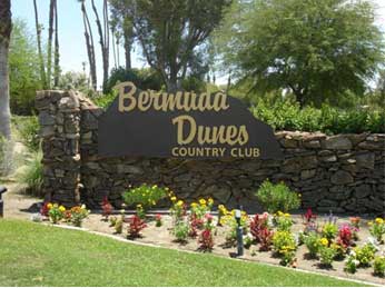
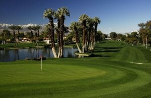
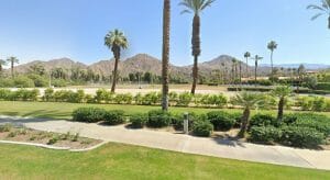
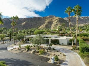
The community’s former name was Myoma. The Bermuda Dunes Country Club was developed in 1958 by Ernie Dunlevie and Ray Ryan; it attracted celebrities such as Clark Gable as members. Bermuda Dunes is served by the Bermuda Dunes Airport.
Geography
Bermuda Dunes is located at 33°44′40″N 116°17′7″W (33.745, -116.285).
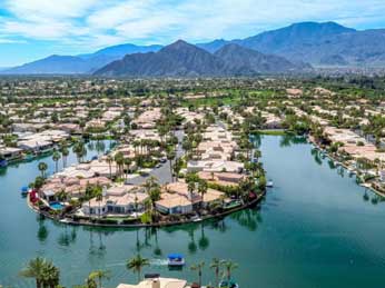
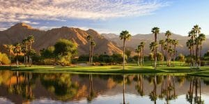
The CDP’s name originated from the Bermuda Dunes country club, a golf course community first opened in 1962 and the former site of the Bob Hope Chrysler Golf Classic. There are 10 other golf clubs and communities within the 5-mile (8.0 km) radius, including Sun City Palm Desert. Bermuda Dunes Airport is located in the community.
Public services
The area’s public services: Education – the Desert Sands Unified School District, plus a private school: Christian Schools of the Desert, which is a preschool – grade 12 school. Electricity is provided by the Indio-based Imperial Irrigation District and Southern California Edison across Washington Street. Water is provided by both the IID the Myoma Dunes Water Company and Telephone service is by Verizon.
According to the United States Census Bureau, the CDP has a total area of 2.9 square miles (7.5 km2), all of it land. The elevation of Bermuda Dunes is 30 feet (9.1 m) above sea level, but the surface drops by over 80 feet (24 m) from west to east.
Terrain and climates telephone area code is 760.
 Located in the Coachella Valley desert region, Bermuda Dunes is sheltered by the San Jacinto Mountains to the west, the Santa Rosa Mountains to the south and by the Little San Bernardino Mountains to the east.
This geography gives Bermuda Dunes its hot, dry climate, with 354 days of sunshine and only 3.44 inches (87.4 mm) of rain annually. Bermuda Dunes has a warm winter/hot summer climate: Its average annual high temperature is 89.5 °F (31.9 °C) and average annual low is 62.1 °F (16.7 °C) but summer highs above 110 °F (43 °C) are common and sometimes exceed 120 °F (49 °C), while summer night lows often stay above 82 °F (28 °C). Winters are warm with daytime highs often between 70–86 °F (21–30 °C) and corresponding night lows falling to 48 °F-68 °F (9 °C-20 °C). The mean annual temperature is 75.8 °F (24.3 °C).
Demographics
2010
At the 2010 census Bermuda Dunes had a population of 7,282. The population density was 2,471.7 people per square mile (954.3/km2). The racial makeup of Bermuda Dunes was 5,433 (74.6%) White (60.2% Non-Hispanic White), 180 (2.5%) African American, 63 (0.9%) Native American, 241 (3.3%) Asian, 11 (0.2%) Pacific Islander, 1,126 (15.5%) from other races, and 228 (3.1%) from two or more races. Hispanic or Latino of any race were 2,371 persons (32.6%).
The census reported that 7,277 people (99.9% of the population) lived in households, 5 (0.1%) lived in non-institutionalized group quarters, and no one was institutionalized.
There were 2,942 households, 927 (31.5%) had children under the age of 18 living in them, 1,456 (49.5%) were opposite-sex married couples living together, 349 (11.9%) had a female householder with no husband present, 178 (6.1%) had a male householder with no wife present.
There were 252 (8.6%) unmarried opposite-sex partnerships, and 32 (1.1%) same-sex married couples or partnerships. 678 households (23.0%) were one person and 211 (7.2%) had someone living alone who was 65 or older. The average household size was 2.47. There were 1,983 families (67.4% of households); the average family size was 2.92.
The age distribution was 1,640 people (22.5%) under the age of 18, 670 people (9.2%) aged 18 to 24, 1,823 people (25.0%) aged 25 to 44, 2,051 people (28.2%) aged 45 to 64, and 1,098 people (15.1%) who were 65 or older. The median age was 39.1 years. For every 100 females, there were 98.1 males. For every 100 females aged 18 and over, there were 93.9 males.
During 2009–2013, Bermuda Dunes had a median household income of $61,519, with 9.4% of the population living below the poverty line.
2000
At the 2000 census there were 6,229 people, 2,595 households, and 1,686 families in the CDP. The population density was 1,969.5 people per square mile (761.1/km2). There were 2,937 housing units at an average density of 928.6 per square mile (358.9/km2).
The racial makeup of the CDP was 84.2% White, 2.1% Black or African American, 0.6% Native American, 2.8% Asian, 0.1% Pacific Islander, 6.9% from other races, and 3.4% from two or more races.
19.5% of the population were Hispanic or Latino of any race, but the statistic isn’t regarded accurate by the United States Hispanic Chamber of Commerce, placed the CDP’s Hispanic percentage well above 30 percent.
Of the 2,595 households 30.4% had children under the age of 18 living with them, 51.2% were married couples living together, 9.6% had a female householder with no husband present, and 35.0% were non-families. 25.6% of households were one person and 8.4% were one person aged 65 or older. The average household size was 2.4 and the average family size was 2.9.
The age distribution was 23.6% under the age of 18, 8.9% from 18 to 24, 29.8% from 25 to 44, 23.6% from 45 to 64, and 14.1% 65 or older. The median age was 38 years. For every 100 females, there were 99.6 males.
For every 100 females age 18 and over, there were 95.8 males. Many retirees (senior citizens) and families with young children moved to Bermuda Dunes enough to have a balance in age demographics.
The median household income was $51,082 and the median family income was $62,453. Males had a median income of $43,900 versus $31,654 for females. The per capita income for the CDP was $29,343. About 4.5% of families and 6.9% of the population were below the poverty line, including 6.2% of those under age 18 and 2.2% of those age 65 or over.
Median house value: $208,400 (year 2000), but said to have increased 300 percent by 2006 ($550,000) to peak at 2009 (over $600,000) before the Great Recession.
Politics
In the California State Legislature, Bermuda Dunes is in the 28th Senate District, represented by Republican Melissa Melendez, and in the 56th Assembly District, represented by Democrat Eduardo Garcia.
In the United States House of Representatives, Bermuda Dunes is in California’s 36th congressional district, represented by Democrat Raul Ruiz.
Notable people
- John J. Benoit (1951–2016), California law enforcement officer and politician.
- Rock Hudson, actor, owned a house in Bermuda Dunes. Author Armistead Maupin edited Tales of the City in the house.
- Casey Merrill, former running back of the Green Bay Packers, New York Giants and New Orleans Saints (NFL).
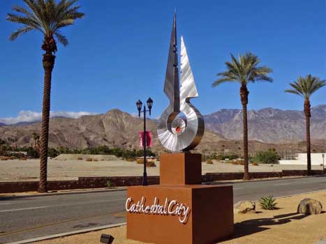
Cathedral City
Cathedral City, colloquially known as “Cat City”, is a desert resort city in Riverside County, California, United States, within the Colorado Desert’s Coachella Valley. Situated between Palm Springs and Rancho Mirage, the city has the second largest population, after Indio, of the nine cities in the Coachella Valley. Its population was 51,200 at the 2010 census.
Prior to the arrival of European explorers and settlers, the land was part of the territory inhabited by the Cahuilla Indians. Today every other square mile of the city is part of the Agua Caliente Band of Cahuilla Indians reservation land. Development of a town began when a housing subdivision was built in 1925, although it was not incorporated until 1981.
 Geography
According to the United States Census Bureau, Cathedral City has a total area of 21.8 square miles (56 km2), of which 21.5 square miles (56 km2) of it is land and 0.3 square miles (0.78 km2) of it (1.18%) is water. GPS coordinates of Cathedral City, California, United States 33.8047, -116.4588.
Demographics
2010
The 2010 United States Census reported that Cathedral City had a population of 51,200. The population density was 2,353.3 people per square mile (908.6/km2). The racial makeup of Cathedral City was 32,537 (63.5%) White (32.3% Non-Hispanic White), 1,344 (2.6%) African American, 540 (1.1%) Native American, 2,562 (5.0%) Asian, 55 (0.1%) Pacific Islander, 12,008 (23.5%) from other races, and 2,154 (4.2%) from two or more races. Hispanic or Latino of any race were 30,085 persons (58.8%).
The Census reported that 50,905 people (99.4% of the population) lived in households, 263 (0.5%) lived in non-institutionalized group quarters, and 32 (0.1%) were institutionalized.
There were 17,047 households, out of which 6,574 (38.6%) had children under the age of 18 living in them, 7,589 (44.5%) were opposite-sex married couples living together, 2,291 (13.4%) had a female householder with no husband present, 1,176 (6.9%) had a male householder with no wife present. There were 1,054 (6.2%) unmarried opposite-sex partnerships, and 779 (4.6%) same-sex married couples or partnerships. 4,292 households (25.2%) were made up of individuals, and 2,259 (13.3%) had someone living alone who was 65 years of age or older. The average household size was 2.99. There were 11,056 families (64.9% of all households); the average family size was 3.67.
During 2009–2013, Cathedral City had a median household income of $44,406, with 20.5% of the population living below the federal poverty line.
2000
As of the census of 2000, there were 42,647 people, 14,027 households, and 9,622 families residing in the city. The population density was 2,224.0 people per square mile (858.5/km2). There were 17,893 housing units at an average density of 933.1 per square mile (360.2/km2). The racial makeup of the city was 65.3% White, about half (50%) of the population is Hispanic or Latino. 2.7% Black or African American, 1.0% Native American, 3.7% Asian, 0.1% Pacific Islander, 23.1% from other races, and 4.1% from two or more races.
According to the 2000 Census, Cathedral City had a total of 14,027 households, 39.3% of which had children under the age of 18 living with them, 50.7% of which were married couples living together, 11.9% of which had a female householder with no husband present, and 31.4% of which were non-families. Approximately 23% of all households were made up of individuals with 11.0% of them consisting of single individuals 65 years of age or older.
The average household size was 3.03 people and the average family size was roughly three and a half people (3.63), which puts Cathedral City above both the California and U.S. averages in those categories.
The median income for a household in the city was $38,887, and the median income for a family was $42,461. Men had a median income of $29,598, and the median income for women was $25,289. The per capita income for the city was $16,215. About 10.2% of families and 13.6% of the total population had incomes below the poverty line, including 16.3% of those under age 18 and 7.9% of those age 65 or over (senior citizens).
Economy
Cathedral City has an automotive mega-dealership known as the Palm Springs Auto Mall based on the city limits with Palm Springs.
Cathedral City hosts an annual Mexican Independence Day festival on every third weekend of September. To commemorate the event, an “el Grito de Dolores” is held at the city hall/movie theater complex.
One of the world’s most technologically advanced cannabis greenhouses is being developed in Cathedral City by the company Sunniva. Once completed, this facility will be approximately 489,000 square feet.
Parks and recreation
Date Palm Country Club and golf course, designed in 1967 and opened in 1971, has an 18-hole “executive style” facility designed by Ted Robinson, ASCCA. It features 3,100 yards (2,800 m) of golf from the longest tees for a par of 58. The course rating is 54.9/57.2 and it has a slope rating of 90/93. It is landscaped in Bermuda Greens and includes lakes and sand traps.
The most memorable tee is the 175 yard 8th hole, which has an accurate tee shot over a lake. The Phil Harris Golf Classic was held there for many years from the 1940s to Phil Harris’ death in 1994. Though built on part of the Agua Caliente Indian Reservation, an exclusive retirement community of manufactured homes lines the greens.
The Big League Dreams Sports Park softball complex is on the corner of Date Palm and Dinah Shore drives, made up of four softball fields designed as replicas of four major league ballparks.
The Pepsi All-Star Softball Game has been held there since 1998. The Cathedral City Soccer Park, next to James Workman Middle School, is where the So Cal Coyotes minor league football team play their games (and also in the Rancho Mirage High School stadium). In 2018–19, the So Cal Coyotes changed leagues and now play in Indio, California in the Shadow Hills High School football stadium.
The nine parks in Cathedral City are:
- Century Park
- Memorial Park
- Ocotillo Park
- Panorama Park
- Patriot Park
- Second Street Park
- Dennis Keat Soccer Park
- Town Square
- Dog Park
An additional park is proposed at Corta Road and Landau Boulevard.
Government
In the California State Legislature, Cathedral City is in the 28th Senate District, represented by Republican Melissa Melendez, and in the 56th Assembly District, represented by Democrat Eduardo Garcia.
In the United States House of Representatives, Cathedral City is in California’s 36th congressional district, represented by Democrat Raul Ruiz.
Education
Cathedral City High School, opened in 1991, is a major educational and recreational center to the city. The varsity football, basketball and soccer teams had earned CIF-southern California championship runs in the late 1990s and 2000s. Cathedral City is also home to Mayfield College, a private college that offers career training in health care, HVAC, technology, and business.
Notable people
- Timothy Bradley, the former WBO welterweight champion, is from Cathedral City and graduated from Cathedral City High School.
- The city was a winter residence for actors Robert Duvall and Martin Landau in the 1960s, and TV show host Monty Hall in the 1990s.
- Chicano folk musician Lalo Guerrero lived in Cathedral City in his final years.
- “Dirty John” Meehan lived in a trailer, on his sister Donna Meehan Stewart’s RV lot in Cathedral City, before marrying Debra Newell.
- Simon Oakland died in the town on August 29, 1983, a day after the actor’s 68th birthday.
- The city was the teenage home of actress Suzanne Somers’ (she still maintains a second home in nearby Palm Springs).
- Frank Sinatra’s grave is located in Desert Memorial Park cemetery, as are those of several other prominent figures, including actor William Powell, singer-songwriter Sonny Bono, former mayor of Palm Springs, and actress Jane Wyman.
Indian Wells
 Indian Wells is a city in Riverside County, California, in the Coachella Valley. Incorporated in 1967, it lies in between the cities of Palm Desert and La Quinta. As of the 2010 Census, the city population was 4,958.
The city hosts the sixth-largest tennis tournament in the world, the Indian Wells Masters tennis tournament, presently known as the BNP Paribas Open. The Indian Wells Masters is one of nine ATP World Tour Masters 1000 high-level events operated by the Association of Tennis Professionals, and one of the four WTA Premier Mandatory tournaments of the Women’s Tennis Association.
It is held at the Indian Wells Tennis Garden, which contains the second-largest tennis-specific stadium in the world.
Demographics
2010
The 2010 United States Census reported that Indian Wells had a population of 4,958. The population density was 339.8 people per square mile (131.2/km2). The racial makeup of Indian Wells was 4,721 (95.2%) White (92.3% Non-Hispanic White), 29 (0.6%) African American, 20 (0.4%) Native American, 83 (1.7%) Asian, 2 (0.0%) Pacific Islander, 52 (1.0%) from other races, and 51 (1.0%) from two or more races. Hispanic or Latino of any race were 209 persons (4.2%).
The Census reported that 4,952 people (99.9% of the population) lived in households, 6 (0.1%) lived in non-institutionalized group quarters, and 0 (0%) were institutionalized.
There were 2,745 households, out of which 193 (7.0%) had children under the age of 18 living in them, 1,519 (55.3%) were opposite-sex married couples living together, 85 (3.1%) had a female householder with no husband present, 46 (1.7%) had a male householder with no wife present.
There were 85 (3.1%) unmarried opposite-sex partnerships, and 36 (1.3%) same-sex married couples or partnerships. 944 households (34.4%) were made up of individuals, and 690 (25.1%) had someone living alone who was 65 years of age or older. The average household size was 1.80. There were 1,650 families (60.1% of all households); the average family size was 2.22.
There were 5,137 housing units at an average density of 352.1 per square mile (135.9/km2), of which 2,285 (83.2%) were owner-occupied, and 460 (16.8%) were occupied by renters. The homeowner vacancy rate was 5.1%; the rental vacancy rate was 15.4%. 4,251 people (85.7% of the population) lived in owner-occupied housing units and 701 people (14.1%) lived in rental housing units.
During 2009–2013, Indian Wells had a median household income of $83,884, with 5.2% of the population living below the federal poverty line.
2000
As of the census of 2000, there were 3,816 people, 1,982 households, and 1,323 families residing in the city. The population density was 288.5 people per square mile (111.4/km2). There were 3,843 housing units at an average density of 290.5 per square mile (112.2/km2). The racial makeup of the city was 96.3% White, 1.5% Asian, 0.4% Black or African American, 0.2% Native American, 0.1% Pacific Islander, 0.5% from other races, and 1.0% from two or more races. 3.0% of the population were Hispanic or Latino of any race.
There were 1,982 households, out of which 8.4% had children under the age of 18 living with them, 63.1% were married couples living together, 3.0% had a female householder with no husband present, and 33.2% were non-families. 28.4% of all households were made up of individuals, and 17.6% had someone living alone who was 65 years of age or older. The average household size was 1.9 and the average family size was 2.3.
The age distribution is 7.6% under the age of 18, 1.5% from 18 to 24, 9.4% from 25 to 44, 35.3% from 45 to 64, and 46.2% who were 65 years of age or older. The median age was 63 years. For every 100 females, there were 89.5 males. For every 100 females age 18 and over, there were 89.3 males.
The median income for a household in the city was $93,986, and the median income for a family was $119,110. Males had a median income of $88,709 versus $49,539 for females. The per capita income for the city was $76,187. About 1.2% of families and 3.4% of the population were below the poverty line, including none of those under age 18 and 2.6% of those age 65 or over.
Geography
 Indian Wells is located at 33°42′57″N 116°20′28″W (33.715755, −116.341109).
According to the United States Census Bureau, the city has a total area of 14.6 square miles (38 km2), of which, 14.3 square miles (37 km2) of it is land and 0.3 square miles (0.78 km2) of it (1.85%) is water.
Climate
This climate is dominated in all months by the subtropical anticyclone, or subtropical high, with its descending air, elevated inversions, and clear skies. Such an atmospheric environment inhibits precipitation.
Politics
Indian Wells has the second-highest percentage of registered Republicans of any city in California, with 65.1% of its 3,027 registered voters registered as Republicans. 19.5% of voters are registered Democrats, and 12.2% declined to state.
In the California State Legislature, Indian Wells is in the 28th Senate District, represented by Republican Melissa Melendez, and in the 42nd Assembly District, represented by ? Chad Mayes.
In the United States House of Representatives, Indian Wells is in California’s 36th congressional district, represented by Democrat Raul Ruiz.
Notable residents
- Desi Arnaz† – singer, actor and developer
- Robert “Bob” Cummings† – actor
- Tony Curtis† – actor
- Ernest E. Debs† – Los Angeles City Council member and Los Angeles County supervisor
- Bob Einstein† – actor, comedy writer and producer
- Dwight D. Eisenhower† – former U.S. president and avid golfer
- Don Fairfield – golfer
- Howard Haugerud† – military pilot, diplomat, businessman and educator
- Skip Homeier† – actor
- Colleen Kay Hutchins† – former Miss America
- Jack Jones – singer
- Robert Kardashian† – lawyer
- Charles Koch – businessman
- Arthur Lake† – actor
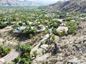
La Quinta
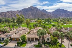
 La Quinta (Spanish for the fifth) is a resort city in Riverside County, California, United States, specifically in the Coachella Valley between Indian Wells and Indio. The population was 37,467 at the 2010 census, up from 23,694 at the 2000 census. The Robb Report credits La Quinta as the leading golf destination in the US.
Among those destinations is the La Quinta Resort and Club, a resort dating to 1926, where director Frank Capra wrote the screenplay for Lost Horizon. The Tom Fazio-designed golf course at The Quarry at La Quinta is ranked among the top 100 golf courses in the United States.
In January 2008, the Arnold Palmer Classic Course at the city’s SilverRock Golf Resort became one of the four host golf courses for the annual Bob Hope Chrysler Classic PGA golf tournament.
Geography
La Quinta is located at 33°40′31″N 116°17′51″W (33.675373, −116.297391). According to the United States Census Bureau, the city has a total area of 35.6 square miles (92 km2), of which, 35.1 square miles (91 km2) of it is land and 0.4 square miles (1.0 km2) of it (1.22%) is water. The city’s elevation is 56 feet (20 m) above sea level.
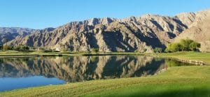
La Quinta is located on the floor of the Coachella Valley, and is surrounded almost entirely by the Santa Rosa Mountains. As the floor of the valley sank, it was covered by the Pacific Ocean. Silt deposits from the flow of the Colorado River into the Gulf of California caused the basin to be cut off from the ocean.
Five hundred years ago, the Colorado River changed its course and the east Coachella Valley flooded, leading to the creation of Lake Cahuilla, which is fresh water.
Santa Rosa Mountains
The most prominent feature of the La Quinta area is its Santa Rosa Mountains. Visitors to Disney California Adventure Park in Anaheim, California, and EPCOT at the Walt Disney World Resort in Bay Lake, Florida, are treated to a brief glimpse of the foothills in one of the park’s attractions: Soarin’ Over California.
The “Palm Springs” segment of Soarin’ Over California was actually shot at the world-famous PGA West golf complex in La Quinta. The Santa Rosa Mountains (California) are nestled against the golf course and can be seen easily in the segment.
The area is very close to the earthquake-causing San Andreas Fault, with some companies offering jeep tours to the fault line.
Climate
The climate of the Coachella Valley is influenced by the surrounding geography. High mountain ranges on three sides contribute to its unique and year-round warm climate, with some of the
warmest winters west of the Rocky Mountains. La Quinta has a warm winter/hot summer climate: Its average annual high temperature is 89.5 °F (31.9 °C) and average annual low is 62.1 °F (16.7 °C) but summer highs above 108 °F (42 °C) are common and sometimes exceed 120 °F (49 °C), while summer night lows often stay above 82 °F (28 °C). Winters are warm with daytime highs often between 68 and 86 °F (20 and 30 °C). Under 4 inches (100 mm) of annual precipitation are average, with over 348 days of sunshine per year. The hottest temperature ever recorded there was 125 °F (52 °C) on July 6, 1905. The mean annual temperature is 75.8 °F (24.3 °C).
Economy
Tourism
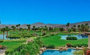
 The city enjoys a healthy tourism industry, especially during the cooler winter months in which “snowbird” tourists arrive. The most prominent industry is golfing with more than twenty golf courses, including the world-famous PGA West, which has hosted prestigious tournaments such as The Skins Game, Bob Hope Chrysler Classic, The Grand Slam of Golf, The Legends of Golf, as well as the PGA Tour Qualifying School. La Quinta has increased the number of retail shopping centers, both discount and high-end retailers brought millions of revenue dollars to the city, and the city council hopes for La Quinta to share a reputation for shoppers like Palm Desert (El Paseo) and Palm Springs (the Village and Palm Canyon) by the end of the decade.
Service industries
In addition to standard service industries, La Quinta is the site of the first Wal-Mart Supercenter in California. Moreover, many residents work for the tourist industries in hotels, resorts, golf courses, and nearby Vegas-style casinos, such as: Spa Resort Casino, Agua Caliente Casino, Spotlight 29, Fantasy Springs and Augustine Casino. There are many service industry jobs related to the construction, hotel, landscaping, and retail industries. La Quinta has sought to bring in high-paying professional businesses to the city and has benefited from neighboring cities’ growth (Indio, Palm Desert and Palm Springs). The city’s downtown commercial district is officially known as “The Village.” The Village District includes private commercial developments such as “Old Town” and “Plaza Calle Tampico,” and contains many professional offices, the City museum, small tourist-oriented shops and boutiques, and several restaurants.
Demographics
2012
As of January 1, 2012, the California Department of Finance Demographic Research Unit estimates the City of La Quinta’s population to be 38,075.
2010
The 2010 United States Census reported that La Quinta had a population of 37,467. The population density was 1,053.9 people per square mile (406.9/km2). The racial makeup of La Quinta was 29,489 (78.7%) White (63.1% Non-Hispanic White), 713 (1.9%) African American, 230 (0.6%) Native American, 1,176 (3.1%) Asian, 41 (0.1%) Pacific Islander, 4,595 (12.3%) from other races, and 1,223 (3.3%) from two or more races. Hispanic or Latino of any race were 11,339 persons (30.3%).
The Census reported that 37,410 people (99.8% of the population) lived in households, 50 (0.1%) lived in non-institutionalized group quarters, and 7 (0%) were institutionalized.
There were 14,820 households, out of which 4,329 (29.2%) had children under the age of 18 living in them, 8,672 (58.5%) were opposite-sex married couples living together, 1,442 (9.7%) had a female householder with no husband present, 595 (4.0%) had a male householder with no wife present. There were 787 (5.3%) unmarried opposite-sex partnerships, and 182 (1.2%) same-sex married couples or partnerships. 3,164 households (21.3%) were made up of individuals, and 1,522 (10.3%) had someone living alone who was 65 years of age or older. The average household size was 2.52. There were 10,709 families (72.3% of all households); the average family size was 2.93.
According to the 2010 United States Census, La Quinta had a median household income of $72,099, with 8.0% of the population living below the federal poverty line.
2000
This article needs additional citations for verification. Please help improve this article by adding citations to reliable sources. Unsourced material may be challenged and removed.
Find sources: “La Quinta, California” – news · newspapers · books · scholar · JSTOR (February 2012) (Learn how and when to remove this template message)
As of the census of 2000, there were 23,694 people, 8,445 households, and 6,553 families residing in the city.
The population density was 746.2 people per square mile (288.1/km2). There were 11,812 housing units at an average density of 372.0 per square mile (143.6/km2). The racial makeup of the city was 78.5% White, 1.4% African American, 0.7% Native American, 1.9% Asian, 0.1% Pacific Islander, 13.9% from other races, and 3.5% from two or more races. Hispanic or Latino of any race were 32.0% of the population.
In the city, the population was spread out, with 29.1% under the age of 18, 6.0% from 18 to 24, 29.0% from 25 to 44, 22.4% from 45 to 64, and 13.4% who were 65 years of age or older. The median age was 36 years. For every 100 females, there were 96.2 males. For every 100 females age 18 and over, there were 93.1 males.
The median income for a household in the city was $54,552, and the median income for a family was $56,848 (these figures had risen to $72,452 and $82,168 respectively as of a 2007 estimate). Males had a median income of $40,553 versus $31,627 for females. The per capita income for the city was $27,284. About 5.0% of families and 7.8% of the population were below the poverty line, including 11.1% of those under age 18 and 4.8% of those age 65 or over.
Government
In the California State Legislature, La Quinta is in the 28th Senate District, represented by Republican Melissa Melendez, and in the 42nd Assembly District, represented by ? Chad Mayes.
In the United States House of Representatives, La Quinta is in California’s 36th congressional district, represented by Democrat Raul Ruiz.
Public safety
Police services are provided under contract with the Riverside County Sheriff’s Department through the Thermal Station, which also serves the city of Coachella and unincorporated areas of the eastern Coachella Valley.
The city of La Quinta contracts for fire and paramedic services with the Riverside County Fire Department through a cooperative agreement with CAL FIRE.
American Medical Response provides ambulance services to La Quinta.
Transportation
The city is part of the SunBus line, which services much of the Coachella Valley.
There is also an airport, Jacqueline Cochran Regional Airport, in the community of Thermal 10 miles (16 km) to the east.
Education
Libraries
The city has a public library that began operations in 2005.
Public schools
The Desert Sands Unified School District services the entire city of La Quinta, and maintains the following public schools:
Elementary
- Harry S. Truman Elementary School
- Benjamin Franklin Elementary School, an IB World School
- Amelia Earhart Elementary School of International Studies, an IB World School
Middle school
- La Quinta Middle School, opened in 1987, a charter school.
- Colonel Mitchell Paige Middle School on the city limits with Palm Desert.
- John Glenn Middle School of Intermediate Studies in nearby Indio.
High school
- La Quinta High School, an IB World School
- Summit High School, an alternative/independent studies school
STEM schools
- John Adams Early Childhood Education Center, formerly Elementary school until 2016.
- George Washington Carver Elementary School.
Alternative schools
- Summit High School, a continuation high school opened in 2006, next to Mitchell Paige Middle School.
- Horizon High School and Horizon Middle School located next to the Desert Sands Unified School District administration building.
Parks
The city of La Quinta has 20 parks:
- Adams Park
- Bear Creek Trail Park
- Colonel Mitchell Paige Soccer Fields
- Cove Oasis
- Desert Pride Park
- Eisenhower Park
- Frances Hack Community Park and YMCA
- Fred Wolff Nature Reserve
- Fritz Burns-La Quinta Community Pool Park
- La Quinta Baseball Fields Park and Gerald Ford Boys and Girls Club Center
- La Quinta Civic Center Park
- La Quinta Trails (hiking and bike trails)
- La Quinta-Westward Ho Park
- Monticello Park
- Pioneer Park
- Saguaro Park
- Seasons Park
- Southside-Santa Rosa Park
- Velasco Park
- Yucatán Park
Lake Cahuilla Regional Park is a Riverside County park, and the Santa Rosa and San Jacinto Mountains National Monument is under the US Department of the Interior / National Park Service.
Notable residents
The city has been home to a number of celebrity residents, including the late Merv Griffin. Griffin was the driving force behind the annual La Quinta Arts Festival, one of the country’s leading plein air art shows, and was instrumental in the development of Griffin Ranch, La Quinta’s first equestrian-oriented resort residential neighborhood.
Two city restaurants are owned by notable residents including professional golfer Arnold Palmer, The Arnold Palmer Restaurant, and Devane’s Old Town, owned and operated by actor William Devane. Both restaurants are located in the La Quinta Village.
Additionally, the musician/actor Tyler Hilton, professional golfer Anthony Kim, and singer/dancer Aubrey O’Day of Danity Kane were also former residents of La Quinta, and all three attended La Quinta High School.
Colonel Mitchell Paige is a World War II Medal of Honor veteran who resided in nearby Palm Desert and had a middle school in La Quinta named for him.
NFL Football player Jeff Webb of the Kansas City Chiefs went to La Quinta High School, though he lived in Indio. Another local and pro football player, Oscar Lua played for the New England Patriots. Current NFL player James Dockery grew up in neighboring Palm Desert and attended Palm Desert High School.
Scott Burcham, a baseball player in the Colorado Rockies organization, was born and grew up in La Quinta.
The band Yawning Man formed there.
Singer and TV personality Andy Williams resided in La Quinta with his second wife Debbie in addition to owning a house in Branson, Missouri, where his Moon River theatre was located.
Olympic ice figure skater Dorothy Hamill lived in La Quinta.
Scientology founder L. Ron Hubbard lived in secret on a ranch in La Quinta from 1978 to the early 1980s.
The singer Jack Jones lives in La Quinta.
Other famous seasonal residents include motivational speaker Tony Robbins, 1970s–80s singing couple Captain & Tennille (Daryl Dragon and Toni Tennille), Flip or Flop’s Tarek El Moussa, and a number of professional golfers including Fred Couples and Monte Scheinblum and Nike founder and CEO until 2016, Phil Knight and wife Penelope “Penny” Knight.
Palm Desert
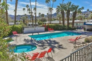
 Palm Desert is a city in Riverside County, California, United States, in the Coachella Valley, approximately 14 miles (23 km) east of Palm Springs, 121 miles (195 km) northeast of San Diego and 122 miles (196 km) east of Los Angeles. The population was 48,445 at the 2010 census, up from 41,155 at the 2000 census. The city was one of the state’s fastest growing in the 1980s and 1990s, beginning with 11,801 residents in 1980, doubling to 23,650 in 1990, 35,000 in 1995, and nearly double its 1990 population by 2000. A major center of growth in the Coachella Valley, Palm Desert is a popular retreat for “snowbirds” from colder climates (the Eastern and Northern United States, and Canada), who swell its population by an estimated 31,000 each winter. Palm Desert has seen more residents become “full-timers”, mainly from the coasts and urban centers of California, who have come for both affordable and high-valued homes.
Geography
According to the United States Census Bureau, the city has a total area of 27.0 square miles (70 km2), of which, 26.8 square miles (69 km2) of it is land and 0.2 square miles (0.52 km2) of it (0.76%) is water.
The elevation (City hall) is 224 feet (68 m) above sea level. Elevations vary from the lower northern half once covered in sand dunes to the upper slope southern cove (300–900 feet or 91–274 metres) all the way to the ridgeline at 1,000 feet (300 m). Palm Desert is located in the Coachella Valley, the north-western extension of the Sonoran Desert.
Sun City Palm Desert, California lies on the northern side of Interstate 10 from Palm Desert itself, but is unincorporated and not part of the City of Palm Desert (the original name was Sun City Palm Springs from 1991 to 1996).
Palm Desert, CA, USA is located at United States country in the Towns place category with the GPS coordinates of 33° 43′ 20.0784” N and 116° 22′ 28.0488” W
Climate
The climate of the Coachella Valley is influenced by the surrounding geography. High mountain ranges on three sides and a south-sloping valley floor all contribute to its year-round warm climate, with the warmest winters in the western United States. Palm Desert has a tropical desert climate: Its average annual high temperature is 89 °F (32 °C) and average annual low is 62 °F
(17 °C), but summer highs above 108 °F (42 °C) are common and sometimes exceed 120 °F (49 °C), while summer night lows often stay above 82 °F (28 °C). Winters are warm with daytime highs between 73–84 °F (23–29 °C). Under 5 inches (130 mm) of annual precipitation are average, with over 348 days of sunshine per year. The mean annual temperature at 75.8 °F (24.3 °C) makes Palm Desert one of the warmest places in the United States. The hottest temperature ever recorded
in Palm Desert was 125 °F (52 °C) on July 6, 1905. The surrounding mountains create a thermal belt in the southern foothills of Palm Desert, leading to a micro-climate with significantly warmer night-time temperatures during the winter months. The University of California maintains weather stations located in this thermal belt as part of their ecological project in the Philip L. Boyd Deep Canyon Desert Research Center.
Demographics
2010
The 2010 United States Census reported that Palm Desert had a population of 48,445. The population density was 1,793.3 inhabitants per square mile (692.4/km2). The racial makeup of Palm Desert was 39,957 (82.5%) White (70.4% Non-Hispanic White), 875 (1.8%) African American, 249 (0.5%) Native American, 1,647 (3.4%) Asian, 55 (0.1%) Pacific Islander, 4,427 (9.1%) from other races, and 1,235 (2.5%) from two or more races. Hispanic or Latino of any race were 11,038 persons (22.8%).
There were 23,117 households, out of which 4,253 (18.4%) had children under the age of 18 living in them, 10,253 (44.4%) were opposite-sex married couples living together, 2,177 (9.4%) had a female householder with no husband present, 811 (3.5%) had a male householder with no wife present. There were 1,227 (5.3%) unmarried opposite-sex partnerships, and 373 (1.6%) same-sex married couples or partnerships. 7,948 households (34.4%) were made up of individuals, and 4,370 (18.9%) had someone living alone who was 65 years of age or older. The average household size was 2.08. There were 13,241 families (57.3% of all households); the average family size was 2.65.
There were 37,073 housing units at an average density of 1,372.4 per square mile (529.9/km2), of which 15,171 (65.6%) were owner-occupied, and 7,946 (34.4%) were occupied by renters. The homeowner vacancy rate was 5.0%; the rental vacancy rate was 16.8%. 30,667 people (63.3% of the population) lived in owner-occupied housing units and 17,470 people (36.1%) lived in rental housing units.
According to the 2010 United States Census, Palm Desert had a median household income of $53,456, with 9.2% of the population living below the federal poverty line.
2000
According to the 2000 United States Census of 2000, there were 41,155 people, 19,184 households, and 11,414 families residing in the city. The population density was 1,689.1 inhabitants per square mile (652.2/km2). There were 28,021 housing units at an average density of 1,150.0 per square mile (444.0/km2). The racial makeup of the city was 86.8% White, 1.2% African American, 0.5% Native American, 2.6% Asian, 0.1% Pacific Islander, 6.5% from other races, and 2.4% from two or more races. Hispanic or Latino of any race were 17.1% of the population.
There are 19,184 households in Palm Desert, out of which 18.9% had children under the age of 18 living with them, 48.5% were married couples living together, 7.7% had a female householder with no husband present, and 40.5% were non-families. 32.4% of all households were made up of individuals, and 15.2% had someone living alone who was 65 years of age or older. The average household size was 2.1 and the average family size was 2.7. The demographics of Palm Desert shows a rising population of children and young adults.
The age distribution of the population was 17.3% under the age of 18, 6.2% from 18 to 24, 22.7% from 25 to 44, 26.3% from 45 to 64, and 27.6% who were 65 years of age or older. The median age was 48 years.
The median income for a household in the city was $48,000 and the median income for a family was $58,183. Males had a median income of $42,257 versus $32,202 for females. The per capita income for the city was $33,463. About 5.9% of families and 9.2% of the population were below the poverty line, including 12.1% of those under age 18 and 4.3% of those age 65 or over.
Government
Palm Desert was incorporated as a city in 1973 and designated a charter city in 1997. It operates on a council-manager form of government. Residents of Palm Desert elect five non-partisan council members who serve four-year staggered terms, with elections occurring every two years. The position of mayor is non-elected and rotates annually among the members of the city council. The council serves to pass ordinances, approve budgets, and hire the city manager and city attorney. The city manager oversees administrative operations and the appointment of department heads.
In the California State Legislature, Palm Desert is in the 28th Senate District, represented by Republican Melissa Melendez, and in the 42nd Assembly District, represented by ? Chad Mayes.
In the United States House of Representatives, Palm Desert is in California’s 36th congressional district, represented by Democrat Raul Ruiz.
Public safety
The Riverside County Sheriff’s Department has a station located in Palm Desert which provides police services to the municipalities of Palm Desert, Rancho Mirage, and Indian Wells, as well as the surrounding unincorporated areas.
The city of Palm Desert contracts for fire and paramedic services with the Riverside County Fire Department through a cooperative agreement with CAL FIRE. Palm Desert currently has three fire stations, which are Station 33, (Town Center), Station 67 (Mesa View), and Station 71 (North Palm Desert). Each fire station provides an engine company and a paramedic ambulance. Fire station 33 also has a truck company.
Education
Palm Desert is the home of the Living Desert Zoo and Gardens, a combination zoo and botanical garden featuring an extensive collection of desert plants and animals and a state-of-the-art animal hospital.
Palm Desert is also the site of the main campus of College of the Desert, the local community college, which has expanded greatly in size since the campus opened in 1961 and one of the buildings was built by donations from the local Cahuilla Indian tribal nations. The state higher education system opened an extension campus duplex (the Indian Wells Education Center for both California State University, San Bernardino and the University of California Riverside.
The primary high school is Palm Desert High School (with 2200 students) which is part of the Desert Sands Unified School District. The main Middle School (with 1100 students) is Palm Desert Middle School, a charter school. The four elementary schools in the city are: George Washington Charter, Abraham Lincoln, Jimmy Carter and Ronald Reagan. The northernmost part of Palm Desert is served by the Palm Springs Unified School District, so the students can attend Rancho Mirage High School in Rancho Mirage, or Nellie Coffman Middle School and Cathedral City High School in Cathedral City, California. Some students in the eastside are zoned to La Quinta High School and Colonel Mitchell Paige Middle School.
The Riverside County Department of Education operates San Cayetano Community School, a grade 1 to 12 educational facility. Palm Desert has 8 private schools in the immediate area: Desert Adventist Academy, Palm Desert Presbyterian School, Sacred Heart Catholic Academy, The Palm Valley School, the Learning Tree Academy, Xavier College Preparatory High School (Catholic-Jesuit), the Hope Academy, and the Desert Torah Academy, a Jewish community school and its social recreational Jewish Community Center. It also has meetings by the Jewish Federation of the Desert based in Palm Springs, serving an estimated 35,000 Jewish people in the Coachella Valley.
Parks
Palm Desert has 14 city parks.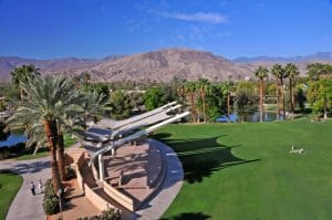
- Cahuilla Hills Park
- Cap Homme/ Ralph Adams Park
- Civic Center Park
- Community Gardens
- Freedom Park
- Hovley Soccer Park
- Ironwood Park
- Joe Mann Park
- Magnesia Falls City Park
- Palm Desert Dog Park
- Palma Village Park
- University Dog Park
- University Park East
- Washington Charter School Park
- South of Palm Desert is the Santa Rosa and San Jacinto Mountains National Monument and North of Palm Desert is the Coachella Valley National Wildlife Refuge.
Cemeteries
The Desert Memorial Park in Cathedral City is maintained by the Palm Springs Cemetery District. Also in Cathedral City is the Forest Lawn Cemetery, maintained by Forest Lawn Memorial-Parks & Mortuaries.
Notable people
Many celebrities keep homes in Palm Desert, including Rita Rudner and more recently, the current home of professional golfer Michelle Wie and one of the homes of Bill Gates. Film producer Jerry Weintraub called Palm Desert his second home before he died. Artist Phillip K. Smith III calls Palm Desert home and his studio is in Palm Desert.
The city is home to the Palm Desert Scene, a musical genre that has been heavily influential internationally since the early 1990s. Many of the Palm Desert bands are credited for starting the rock/metal subgenre known as stoner rock. Bands including Queens of the Stone Age, Kyuss, and Eagles of Death Metal have become well known rock bands.
Palm Springs
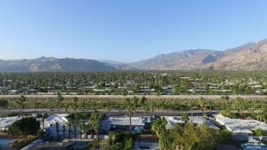 Palm Springs is a desert resort city in Riverside County, California, United States, within the Colorado Desert’s Coachella Valley. The city covers approximately 94 square miles (240 km2), making it the largest city in Riverside County by land area. With multiple plots in checkerboard pattern, more than 10% of the city is part of the Agua Caliente Band of Cahuilla Indians reservation land. Traditionally the Cahuilla refer to the Palm Springs area as Sec-he or Se-Khi.
Although the population of Palm Springs was 44,552 as of the 2010 census, because Palm Springs is a retirement location, as well as a winter snowbird destination, the city’s population triples between November and March.
The city is noted for its mid-century modern architecture, design elements, arts and cultural scene, and recreational activities.
Geography
Palm Springs is located in the Sonoran Desert. According to the United States Census Bureau, the city has a total area of 95.0 square miles (246 km2),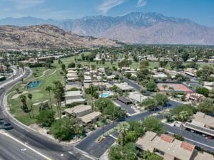 of which 94.1 square miles (244 km2) is land and 0.9 square miles (2.3 km2) (1%) is water. Located in the Coachella Valley desert region, Palm Springs is sheltered by the San Bernardino Mountains to the north, the Santa Rosa Mountains to the south, by the San Jacinto Mountains to the west and by the Little San Bernardino Mountains to the east.
Palm Springs, CA, USA is located at United States country in the Cities place category with the GPS coordinates of 33° 49′ 49.8612” N and 116° 32′ 44.1636” W.
Climate
Palm Springs has a hot desert climate, with over 300 days of sunshine and 4.93 inches (125.2 mm) of precipitation annually. The winter months are warm, with a majority of days reaching 70 °F (21 °C) and in January and February days often see temperatures of 80 °F (27 °C) and on occasion reach over 90 °F (32 °C), while, on average, there are 17 nights annually dipping to or below 40 °F (4 °C); freezing temperatures occur in less than half of years. The lowest temperature recorded is 19 °F (−7 °C), on January 22, 1937.
Summers are extremely hot, with daytime temperatures consistently surpassing 110 °F (43 °C) while overnight temperatures often remain above 80 °F (27 °C). The mean annual temperature is 74.7 °F (23.7 °C). There are on average 180 days with a high reaching 90 °F (32 °C), and 100 °F (38 °C) can be seen on 116 days. The highest temperature on record in Palm Springs is 123 °F (51 °C), most recently achieved on July 28 and 29, 1995. The climate year-round is suitable for many palm trees in this area of California due to the amount of sunny days annually, the average high temperatures, and daily low temperatures.
Ecology
The locale features a variety of native Low Desert flora and fauna. A notable tree occurring in the wild and under cultivation is the California Fan Palm, Washingtonia filifera.
Neighborhoods
The City of Palm Springs has developed a program to identify distinctive neighborhoods in the community. Of the 45 neighborhoods, 7 have historical and cultural significance.
Demographics
2010
The 2010 United States Census reported that Palm Springs had a population of 44,552. The population density was 469.1 inhabitants per square mile (181.1/km2). The racial makeup of Palm Springs was 33,720 (75.7%) White (63.6% Non-Hispanic White), 1,982 (4.4%) African American, 467 (1.0%) Native American, 1,971 (4.4%) Asian, 71 (0.2%) Pacific Islander, 4,949 (11.1%) from other races, and 1,392 (3.1%) from two or more races. Hispanic or Latino of any race were 11,286 persons (25.3%).
The Census reported that 44,013 people (98.8% of the population) lived in households, 343 (0.8%) lived in non-institutionalized group quarters, and 196 (0.4%) were institutionalized.
The population was spread out, with 6,125 people (13.7%) under the age of 18, 2,572 people (5.8%) aged 18 to 24, 8,625 people (19.4%) aged 25 to 44, 15,419 people (34.6%) aged 45 to 64, and 11,811 people (26.5%) who were 65 years of age or older. The median age was 51.6 years. For every 100 females, there were 129.3 males. For every 100 females age 18 and over, there were 133.8 males.
There were 34,794 housing units at an average density of 366.3 per square mile (141.4/km2), of which 13,349 (58.7%) were owner-occupied, and 9,397 (41.3%) were occupied by renters. The homeowner vacancy rate was 6.7%; the rental vacancy rate was 15.5%. 24,948 people (56.0% of the population) lived in owner-occupied housing units and 19,065 people (42.8%) lived in rental housing units.
During 2009–2013, Palm Springs had a median household income of $45,198, with 18.2% of the population living below the federal poverty line.
2000
As of the census of 2000, there were 42,807 people, 20,516 households, and 9,457 families residing in the city. The population density was 454.2 inhabitants per square mile (175.4/km2). There were 30,823 housing units at an average density of 327.0 per square mile (126.3/km2). The racial makeup of the city was 78.3% White, 3.9% African American, 0.9% Native American, 3.8% Asian, 0.1% Pacific Islander, 9.8% from other races, and 3.1% from two or more races. Hispanic or Latino of any race were 23.7% of the population.
In the city, the population was spread out, with 17.0% under the age of 18, 6.1% from 18 to 24, 24.2% from 25 to 44, 26.4% from 45 to 64, and 26.2% who were 65 years of age or older. The median age was 47 years. For every 100 females, there were 107.8 males. For every 100 females age 18 and over, there were 107.4 males.
The median income for a household in the city was $35,973 and the median income for a family was $45,318. Males had a median income of $33,999 versus $27,461 for females. The per capita income for the city was $25,957. About 11.2% of families and 15.1% of the population were below the poverty line, including 28.2% of those under age 18 and 6.8% of those age 65 or over.
Economy
Though celebrities still retreat to Palm Springs, many today establish residences in other areas of the Coachella Valley. The city’s economy now relies on tourism, and local government is largely supported by related retail sales taxes and the TOT (transient occupancy tax). It is a city of numerous festivals, conventions, and international events including the Palm Springs International Film Festival.
The world’s largest rotating aerial tramcars (cable cars) can be found at the Palm Springs Aerial Tramway. These cars, built by Von Roll Tramways, ascend from Chino Canyon two and a half miles (4 km) up a steep incline to the station at 8,516 feet (2,596 m). The San Jacinto Wilderness is accessible from the top of the tram and there is a restaurant with notable views.
The Palm Springs Convention Center underwent a multimillion-dollar expansion and renovation under Mayor Will Kleindienst. The City Council Sub-Committee of Mayor Kleindienst and City Council Member Chris Mills selected Fentress Bradburn Architects from Denver, Colorado for the redesign.
Numerous hotels, restaurants and attractions cater to tourists, while shoppers can find a variety of high-end boutiques in downtown and uptown Palm Springs. The city is home to 20 clothing-optional resorts including many catering to gay men. Downtown Palm Springs shopping is anchored by historic La Plaza, built in 1936.
Parks and recreation
City parks include:
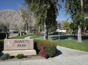
- Baristo Park
- DeMuth Park
- Desert Healthcare (Wellness) Park
- James O. Jessie Desert Highland Unity Center
- Dog Park (behind city hall)
- Frances Stevens Park
- Ruth Hardy Park
- Sunrise Park
- Victoria Park
Recreation
The Palm Springs Desert Ice Palace ice skating rink opened in nearby Cathedral City in October 2011.
- Boomers! is a family entertainment center in Cathedral City.
- A city skatepark was designed after the noted Nude Bowl.
- CNL Financial Group operates the Wet’n’Wild Palm Springs water park in the summer. (Formerly operated as Knott’s Soak City by Cedar Fair Entertainment Company.
In 1931 the Desert Riders was established. Starting off as a social organization for the cream of Palm Springs society, the group sponsors horseback riding and trail building for equestrians, hikers, and bicyclists. The Desert Riders were also significant in providing combination chuckwagon meals and rides through nearby canyons to hotel guests as Palm Springs developed its tourist industry.
Rancho Mirage
 Rancho Mirage is a city in Riverside County, California, United States. The population was 17,218 at the 2010 census, up from 13,249 at the 2000 census, but the seasonal (part-time) population can exceed 20,000. Located between Cathedral City and Palm Desert, it is one of the nine cities of the Coachella Valley (Palm Springs area). Rancho Mirage was incorporated in 1973 from a merger of Mirage Cove with five unincorporated areas known as the “Cove communities” (Desert, Magnesia, Palmas, Tamarisk, and Thunderbird), and had 3,000 permanent residents at the time.
Geography and climate
According to the United States Census Bureau, the city has a total area of 24.8 square miles (64 km2), of which, 24.4 square miles (63 km2) of it is land and 0.4 square miles (1.0 km2) of it (1.57%) is water, including the 10-story Desert Island Hotel-Golf Resort built on an island surrounded by an artificial lake.
GPS coordinates of Rancho Mirage, United States. Latitude: 33.7397 Longitude: -116.4128.
Climate
The climate of the Coachella Valley is influenced by the surrounding geography. High mountain ranges on three sides and a south-sloping valley floor all contribute to its unique and year-round warm climate, with the warmest winters in the western United States. Rancho Mirage has an arid climate: Its average annual high temperature is 87 °F (31 °C) and average annual low is 63 °F (17 °C) but summer highs above 108 °F (42 °C) are common and sometimes exceed 120 °F (49 °C), while summer night lows often stay above 82 °F (28 °C). Winters are warm with daytime highs between 73–84 °F (23–29 °C). Under 5 inches (130 mm) of annual precipitation are average, with over 348 days of sunshine per year.
Demographics
2010
The 2010 United States Census reported that Rancho Mirage had a population of 17,218. The population density was 693.3 people per square mile (267.7/km2). The racial makeup of Rancho Mirage was 15,267 (88.7%) White (81.7% Non-Hispanic White), 256 (1.5%) African American, 94 (0.5%) Native American, 651 (3.8%) Asian, 14 (0.1%) Pacific Islander, 598 (3.5%) from other races, and 338 (2.0%) from two or more races. Hispanic or Latino of any race were 1,964 persons (11.4%).
The census reported that 17,154 people (99.6% of the population) lived in households, 16 (0.1%) lived in non-institutionalized group quarters, and 48 (0.3%) were institutionalized.
 There were 14,243 housing units at an average density of 573.5 per square mile; of the occupied units 7,089 (80.3%) were owner-occupied and 1,740 (19.7%) were rented. The homeowner vacancy rate was 5.0%; the rental vacancy rate was 17.2%. 13,845 people (80.4% of the population) lived in owner-occupied housing units and 3,309 people (19.2%) lived in rental housing units.
Between 2009 and 2013, Rancho Mirage had a median household income of $77,526, with 13.6% of the population living below the federal poverty line.
2000
As of the census of 2000, there were 13,249 people in 6,813 households, including 4,074 families, in the city. The population density was 544.9 people per square mile (210.4/km2). There were 11,816 housing units at an average density of 486.0 per square mile (187.7/km2). The racial makeup of the city was 92.7% White, 0.9% African American, 0.2% Native American, 1.3% Asian, 0.1% Pacific Islander, 3.6% from other races, and 1.3% from two or more races. Hispanic or Latino of any race were 9.4% of the population.
 Of the 6,813 households 10.5% had children under the age of 18 living with them, 52.9% were married couples living together, 5.2% had a female householder with no husband present, and 40.2% were non-families. 32.3% of households were one person and 19.8% were one person aged 65 or older. The average household size was 1.9 and the average family size was 2.4.
The median household income was $59,826 and the median family income was $78,384. Males had a median income of $50,027 versus $36,529 for females. The per capita income for the city was $58,603. About 4.4% of families and 5.9% of the population were below the poverty line, including 9.4% of those under age 18 and 3.2% of those age 65 or over.
Government
In the California State Legislature, Rancho Mirage is in the 28th Senate District, represented by Republican Melissa Melendez, and in the 42nd Assembly District, represented by ? Chad Mayes.
In the United States House of Representatives, Rancho Mirage is in California’s 36th congressional district, represented by Democrat Raul Ruiz.
Education
There is one elementary school (Rancho Mirage Elementary) and one high school Rancho Mirage High School in the city limits which are part of the Palm Springs Unified School District, the newly renovated Nellie Coffman Middle School is on the city line with Cathedral City. There is one private school, Palm Valley School, which covers grades preschool-12th. The PSUSD is building a new grade-middle school complex on the lands of the former Walter Annenberg estate donated to the PSUSD. The complex has yet to be constructed. Rancho Mirage is also home to a campus of Santa Barbara Business College, a private college that offers academic degrees and career training.